Showing posts with label Presidential Range. Show all posts

Wednesday, August 30, 2017

Mt. Jefferson - 5712' Mt. Washington - 6288' (42/48)

Bundled-up Vivian
Paloma and I finally committed to getting back on the trails and finishing up our quest to hike the 48.  We had our sights set on summitting Mt. Jefferson via the Caps Ridge Trail on Sunday, August 20th, however poor weather and the fact we were hiking with our 16-month old, Vivian, caused us to turn around about a half-mile from the summit.  We were bummed but knew that we made the right decision, especially after talking with others who did go to the summit and told us it was miserable.  I will say, though, she looked pretty cozy bundled up in my Deuter Kid Comfort Air carrier!

We decided to return to conquer Jefferson less than a week later, on Saturday, August 26th.  This time, however, we decided to up the ante and add Mt. Washington to the plan.  Given our experience the week prior, we decided that hiking in the Presidential's with a 16-month old might not be the best plan given the unpredictability of the weather and the long hours we would be hiking, so we recruited my parents to join us on our trip to hang with Vivian while we hiked.   We arrived at the Caps Ridge trail-head at just after 9:00AM, made our final preparations and were on the trail at 9:25AM.  The weather at the base was just above 50 degrees and the skies were clear.
Beautiful Day

Our route for the day was to take the Caps Ridge Trail up to the summit of Jefferson, then take a short jaunt down the Jefferson Loop Trail to connect to the Gulfside trail across to Washington.  To reach the summit of Washington we would take the Trinity Connector.  Our plan was to descend to the Lake of the Clouds hut via the Crawford Path, and finally return to the base of Washington via the Ammonoosuc trail.  A total distance of 10.5 miles or so.

Climbing the Caps
The Caps Ridge trail is unique in that the trail-head starts at such a high elevation that you break treeline within a short period of time.  The trail is relatively mild early on but was a bit overgrown - surprising since it seems like it is well used.  You are treated to some decent views pretty early on - this particular day was nice and clear so the views were fantastic.  Quite a difference from the week prior.  Once you break treeline you begin to climb over the Caps - a series of rock outcrops that require some bouldering to get over.  It is actually quite a fun trail to climb on.  As we climbed to around 5000' the temperature started to drop significantly, so Paloma and I both put on our fleece jackets and rain shells.

Summit of Mt. Jefferson
We reached the summit of Jefferson at 11:30AM.  It was quite breezy at the top and we were in and out of the clouds.  When the clouds cleared we were treated to amazing views over to Mt. Adams and Mt. Madison, as well as over to our destination - Mt. Washington.  Woof - it looked like quite a trek to get over there!  We spent only a few minutes on the summit of Jefferson as we were eager to begin our trek across the range to Mt. Washington.

The Cog Railway
The Gulfside trail is actually quite pleasant and easy going, though even though were were keeping a pretty good pace Washington still looked quite far.  Halfway between Jefferson and Washington is Mt. Clay, which although is over 5000' tall, doesn't qualify for the 4000 Footer list due to the prominence rules.  We were tempted to take the Mt. Clay Loop to bag this mountain as well, but given the time we decided to stick to the Gulfside Trail and skip the elevation gain to bag Mt. Clay.  The views along the Gulfside trail were phenomenal, and it really highlighted the scale of the Presidential Range.

 Paloma on the Gulfside Trail
After we circumvented Mt. Clay, we emerged onto the shoulder of Mt. Washington and quickly came to an intersection with the Cog Railway.  We reached the tracks just in time to see one of the trains going by - this was pretty cool.  As we waived to the passengers descending via the train, half of me was thinking about what wussies they were taking a train to visit the summit of Washington, though the other half of me was tempted to hitch a ride down.  We got a bit turned around at this point and had to backtrack a bit to get back on the correct path to the summit.  This involved climbing alongside the train tracks, which got the legs burning as the ground was quite soft and the pitch was quite steep.  We finally found our way back to the trail and began climbing steadily to the summit of Washington.  The final approach was via the Trinity Connector, and before we knew it we were standing on top of the tallest of the 48 4000 footers, the mighty Mt. Washington.  The time was 1:40PM.

Ugh!
For those unfamiliar with Mt. Washington - lets just put it this way...the summit is a shit-show.  I've purposely put off hiking Mt. Washington because most people who climb it end up being disappointed because they have found the summit to be swamped with people who either took the Cog Railway or Auto Road to the top.  Well folks, that is exactly what we experienced.  We had to wait in a twenty minute long line to get our photo with the sign at the summit.  It was not enjoyable.

Summit of Mt. Washington
Now - I am not knocking people for driving or taking the railway up - just a few months ago Paloma, Viv and I drove to the summit of 14k foot Pike's Peak in Colorado and had a great time.  But it is quite a let down to have hiked for so long and to not be able to enjoy the summit.  Oh well - I knew what we were getting into.  After we snapped our summit photo we decided to get the heck out of dodge, and began our descent to the Lake of the Clouds hut at 2:00PM.

Lake of the Clouds
The hike down Crawford Path to the hut was relatively mild.  As we hiked we watched someone fly a drone, presumably taking some cool aerial shots of the Lake of the Clouds.  We reached the hut at 2:45PM.  If I could turn the Lake of the Clouds hut into my full-time residence I would do it in a heartbeat.  What a gorgeous setting.  Flanked by Mt. Washington and Mt. Monroe, the hut sits on the shore of a crystal clear lake that Paloma pointed out almost resemble those infinity pools you see at high end Caribbean resorts.  We stopped in the hut to use the facilities and I was tempted by some delicious smelling brownies that must have just been made by one of the crew members there.  I was good though and passed.  I wanted to spend more time at the hut but it was now 3:00PM, so we decided to begin the final section of our hike via the Ammonoosuc Ravine trail.

Swimming Hole
The Ammonoosuc Ravine trail skirts down the ravine alongside the Ammonoosuc river.  It was a bit steep at the top so we had to take some care in our descent.  What a beautiful trail, though.  There are a number of small waterfalls and swimming holes along the trail, and great views back up towards Mt Washington.  We kept a decent pace as we got lower on the trail, and reached the Cog Railway parking lot at 4:50PM.  What a great but exhausting day of hiking.  We reunited with my parents and little Vivian and began the drive back home.  I was pooped!

All in all this is a fantastic hike.  It is decently strenuous but the hike along the Gulfside Trail is mild and gives you a decent recovery period before ascending Washington.  Make sure you check the weather before doing this hike, though, as you are exposed for several miles.  42 down, 6 to go!

Hike Stats
Trails: Caps Ridge, Jefferson Loop, Gulfside, Trinity Connector, Crawford Path, Ammonoosuc Ravine
Total Time (Including Breaks): 7:25
Distance: 10.5 Miles
Elevation Gain: ?? (If anyone has an accurate Elevation calculation of this route, please let me know!)

Monday, September 29, 2014

Mt. Monroe - 5384' Mt. Eisenhower - 4780' (33/48)


Edmand's Path Trail-head
With the weather forecast looking absolutely gorgeous for this late in September, Paloma and I decided to tackle the two remaining southern Presidential mountains on our list, Mt. Monroe and Mt. Eisenhower.  On Saturday morning we set off for the Edmand's Path trail-head, located on Mt. Clinton road off of Route 302 in NH, at approximately 6:40AM.  The ride up was relatively uneventful and quick - the weather was looking great, 65 degrees and not a cloud in the sky.

Paloma's Best "I'm Scared" Face
When we arrived at the trail-head the parking lot was already full but we were able to find a spot alongside the road just outside of the lot.  Looked like there were plenty of others taking advantage of the weather.  We threw on our gear and made our final preparations, officially beginning our hike at 9:10AM.  Our route for the day was to hike up Edmand's Path to the junction with the Crawford Path, hike over to Mt. Monroe, and then return and summit Mt. Eisenhower, returning back to the car by Edmand's Path - a total of 9.8 miles round-trip.

The Ridge
The beginning of Edmand's Path was very easy and the trail was in excellent shape.  Early on we crossed a few streams on well-built man-made bridges.  I was surprised at how dry the trail was given that nearly every trail in the White Mountains we have hiked on have been pretty wet.  Needless to say, we were cruising at a pretty good pace.  After a mile or so the trail began to steepen a bit but remained pretty mild until only a half-mile or so before the junction with Crawford Path.  The trees began to thin quite quickly and we could begin to hear the whistles from the Cog Railway across the ridge on Mt. Washington.  We also began to catch some views of the Presidential Range and down to the Mt. Washington Resort.  Things were looking beautiful.

Shoulder of Eisenhower
When we finally emerged from the trees onto the rocky shoulder of Mt. Eisenhower, we were treated with views that were nothing short of amazing.  It seemed fake.  Both of us were in awe at how beautiful it was.  One would think that after hiking so many mountains with great views that it would get old, but no...it doesn't.  We continued skirting along the rocky shoulder of Eisenhower until we reached the junction with Crawford Path, reaching it at 10:57AM.  There were quite a few people climbing up to the the summit of Eisenhower, so Paloma and I decided to head over to tackle Mt. Monroe first.

As we eventually learned, you cannot see the summit of Mt. Monroe from Mt. Eisenhower. It is indeed, actually quite far away but is blocked by some rolling hills.  When we got to the top of the first rolling hill we realized we were only about a quarter of the way there.  The hike along the exposed ridge was awesome, though.  The sun was shining so even though it was windy it was quite warm.  I even managed to get a bit of a sunburn on my face.  We eventually passed the summit of Mt. Franklin, a non-4k and continued over towards Monroe.

Looking back towards Eisenhower
When we reached the junction of Crawford Path with the Monroe Loop, we got a bit mixed-up,  If you continue on Crawford Path you actually circumvent the summit of Monroe.  We started this way for a few hundred yards but realized quickly that it was not leading us to the summit.  We backtracked and took the Monroe loop up.  Whoever designed this trail is a sick, sick person.  The trail literally climbs up the steepest outcrop of rocks before bearing right across a field to the final climb up Monroe.  If the trail was just 100 yards to the right you would avoid this rocky mess but no, the trail decides to go right over it.  Oh well, the views from the top of this rocky mound were great.  After this we cut across an alpine field and began the final climb up the rocks to the summit of Monroe, reaching it at 12:25PM.

Summit of Mt. Monroe
There were a few other people at the summit soaking in the sun and views but it was much less crowded than the summit of Eisenhower which we could now see, miles away across the ridge.  We enjoyed beautiful views of Mt. Washington and the Lake of the Clouds while eating lunch hunkered down behind a large boulder.  It was quite windy at the top which was actually quite refreshing.  It was neat to look back across the ridge we had just hiked across to Eisenhower, though knowing that we had to hike back all that distance seemed daunting.  We let our food digest for a few minutes and were back on the trail at 12:40PM.

Summit of Mt. Eisenhower
Thankfully the hike back across the ridge was quite a bit faster than our hike out.  We were cruising back towards Eisenhower, passing many people along the way.  I had to ask Paloma what she put in our PB&J sandwiches because my energy level was at an all time high.  We reached the original junction of Crawford Path with Edmand's Path at 1:36PM, this time continuing straight towards Eisenhower.  At this point it was quite crowded, so we decided to haul ass to the summit of Eisenhower, take a few photos, and began the descent to the car.  We reached the summit at 1:50PM, snapped our photos, and were on our way down at 1:56PM.  I hate crowds.

Our hike down was the fastest hiking I have ever done.  Aside from getting stuck behind people at many points, we were borderline running down Edmand's Path.  I was treading a thin line between hiking fast and being completely out of control on the descent, grabbing onto trees and sliding down boulders.  Paloma and I both worked up quite a sweat on the way down the trail.  Unfortunately, many people on the way down seemed to have little knowledge of trail courtesy.  If someone is coming up from behind you, move aside and let them pass!  There were numerous points where we were right on the heels of groups of others and it took ten minutes for them to finally stop and move over.  Annoying!

Paloma and I at the Summit of Eisenhower
Near the end of the hike we crossed back over the streams we had crossed at the beginning.  Submerged in the last stream was a man making strange grunting noises, clearly enjoying the refreshing water as his dog sat on the shore with a bewildered look on his face as if saying "I am NOT with this guy."  Hey, to each their own I guess.  It did, after all, look quite refreshing.  We finished the final few hundred yards of the hike, reaching our car at 3:22PM.  Overall this hike was on the easier side and had some tremendous views.

We quickly changed into new clothing and began the ride home.  I was shocked at how many cars were parked along the various trail-heads that we passed on the ride.  It looked like everybody and their brother were hiking the Franconia Ridge mountains as cars were parked for what seemed like miles on each side of Rt. 93.  We stopped at the Lucky Dog Tavern in Plymouth on our way home for dinner and ate perhaps the best plate of nachos I have ever consumed - pulled pork nachos with cheddar cheese and diced pickles.  Sounds strange but was absolutely phenomenal.  All in all a solid day in the mountains!

Hike Stats
Trails: Edmand's Path, Crawford Path
Total Time (Including Breaks): 6:10
Distance: 9.8 Miles
Elevation Gain: 3,800'

Sunday, September 7, 2014

Mt. Isolation - 4004' (31/48)


Rocky Branch Trailhead
The time had come for Paloma and I to stop putting off hiking Mt. Isolation.  I'll admit, I have always been a bit intimidated to do this hike just due to the sheer length of it.  I had heard it isn't overly difficult but with a name like Mt. Isolation one has to have a little fear in them of hiking it.  We set off early on Saturday morning, an after a relatively uneventful yet slow ride up Rt. 16, we arrived at the Rocky Branch parking lot at quarter of ten.  The weather at the base was a bit cloudy and warm, and the lot was relatively empty except for about four or five other cars.  Knowing that we had a long hike ahead of us and it was already later than we had hoped, we threw on our gear and officially started our hike at 10:00AM.

Sweaty Animals!
Our route for the day was a 14.6 mile hike out and back up the Rocky Branch, Isolation, and Davis Path trails to the summit of Isolation.  We started on the Rocky Branch trail which began gaining elevation nearly the minute we left the parking lot.  The weather in the woods felt like a hot blanket over us, extremely humid with little to no breeze.  Oh boy, this was going to be a long day.  About fifteen minutes into the hike and I was already sweating like an animal - the humidity made it extremely difficult to breathe in any sort of rhythm.  After we passed a place where a ski trail veers off the right, the climbing continued and steepened.  Paloma and I were praying that it would eventually even out.

We encountered our first human shortly thereafter.  Before we got even within ten feet of this individual he proclaimed "I read your blog!  You are Tom and Paloma!"  Awesome, I thought to myself, this was the most proud I have been since beginning this blog.  Someone actually read it and recognized me!  We spoke with the man, named Doug, for a few minutes and discussed some other hikes we had done.  He was on his way down at this point after spending a night at the Rocky Branch shelter.  Doug - if you are reading this post hope the rest of your hike went well and I hope to see you on the trails again!  After our brief chat with Doug, Paloma and I continued on our way.

River Crossing
After a few more minutes we final hit level land, and the hike remained this way all the way to the junction with the Mt. Isolation trail and the Rocky Branch river.  What a relief!  Paloma and I both felt a renewed sense of energy and suddenly the completion of this hike didn't seem like such a difficult task after all.  After crossing over the Rocky Branch river we reached the junction with the Mt. Isolation trail at 11:55AM.  We contemplated checking out the shelter which was a few hundred yards in the opposite direction, but decided against it since we still had over ten miles to go - maybe someday we will hike to the shelter and actually spend the night - it seems like it is in a beautiful location!

Paloma Navigating the River
The Mt. Isolation trail follows along the river for a few miles, crossing it back and forth approximately five times.  The river crossings were not too difficult but I can imagine after a lot of rain or melting snow that they could be tough.  There were a couple of points where we couldn't exactly tell if the trail crossed the river or not, but thankfully there were some makeshift cairns that helped guide the way.  We were cruising pretty good at this point, trying to get as many miles behind us as possible.  After the river section we came into some muddy and wet sections of the trail, and both of us were slowly becoming covered in mud.  

What happened here?
We finally began to catch our first "views" off to the left as we emerged onto some sort of ridge.  This was a very interesting section of the trail.  I couldn't exactly figure out what happened but it looked like one of those micro-bursts or some sort of significant wind activity bent down (but didn't break) hundreds of pine trees.  I attempted to capture this in the photo here but I don't think it does it justice.  You will have to hike there to see just how interesting it looks!  We cruised through this section and shortly thereafter reached the junction with the Davis Path trail.

The Jerk!
The Davis Path trail, though easy, had plenty of PUDs to get your heart rate going.  PUDS = pointless up and downs.  Regardless, the excitement we had that the summit was less than a mile away took our minds off of how worn out we were and before we knew it we reached the Mt. Isolation spur - a steep but short climb to the summit.  There we encountered perhaps our biggest challenge.  In the middle of the trail, perched on a rock, was a little plastic toy soldier guarding the trail, protecting the summit of Mt. Isolation.  After being nearly denied passage, I finally reached into my wallet and gave him all of its contents for the right to pass.  He obliged.  Thank God!  Would have sucked climbing all that way only to have to turn back a hundred feet from the summit!

Summit of Mt. Isolation
We finally emerged from the trees to the summit of Mt. Isolation at 1:48PM and were treated with beautiful views of the Presidential Range and surrounding mountains.  There was another couple at the top and their beautiful dog, Ginger, who just completed her (the dog) 48th 4k.  Impressive!  Ginger took a liking to Paloma and I was worried that Paloma was going to hike down with Ginger and leave me by my lonesome.  We chatted for a bit with the other couple and then sat down for a well deserved lunch of PB&Js, chips, and Gatorade.  I could have fallen asleep at the top but since we had over seven miles to get back to the car, we wolfed down our food, took a couple photos, and began the long descent back to the car.

Paloma and I at the top!
We were cruising, and at some points lightly jogging, down the Davis Path, reaching the junction in about half the amount of time it took us on the way up.  By the time we arrived back at the portion of the trail that zigzags across the Rocky Branch river, a light rain began.  It actually felt quite refreshing and I joked with Paloma that it was good that it was raining because it meant we wouldn't be as stinky and muddy at dinner after the hike.  Maybe I should have held that thought to myself, as minutes later we were stuck in a full on downpour.  It still felt refreshing so I forewent putting on a rain jacket, rather Paloma tied it over my backpack to protect its contents.  Normally rain would annoy me but in this case I welcomed it.  That is, for the first ten minutes.  When it didn't stop for the next hour it got a bit old.

The last three miles of the hike took FOREVER, or at least it seemed that way.  I think I guessed that we were just about at the car over fifteen times.  Nope, more to go.  The rain made things a bit tricky as now everything was wet and slippery - this prevented us from being able to move too fast.  Just when I was about at the point where I contemplated laying down and giving up, I spotted our car through the trees.  At last, we were at the end!  We reached the car 5:38PM and immediately shed our boots.  Relief!  

Caught in the Rain
We both changed and agreed that we were going to stop at the first restaurant we came to.  That happened to be the Red Fox Bar & Grille in Jackson, NH.  I wolfed down some meat, potatoes, and a beer, Paloma a brick-oven pizza.  After-all we deserved it!  We must have looked like two goons as we hobbled in and out of the restaurant!  The ride home was uneventful, and I immediately hit the hay after a hot shower.  What a day!

Overall this was a long but not technically difficult hike.  The trails were in decent condition and the crossings weren't difficult though the hike up doesn't offer many views.  The views at the top, however, are great.  I think we saw more toads than people so this would be a great hike for people looking to avoid the crowds.  It is called, after all, Mt. Isolation...

Hike Stats
Trails: Rocky Branch, Isolation, Davis Path
Total Time (Including Breaks): 7:40
Distance: 14.6 Miles
Elevation Gain: 3,400'


Sunday, June 29, 2014

Wildcat Mountain (A Peak) - 4422' Wildcat Mountain (D Peak) - 4050' (28/48)

Wildcat Ridge Trail Head
After what seemed like an eternity, my foot was finally feeling strong enough to test out on the trails.  The great weather we have been having lately had my mind on the mountains, and I was happy to finally get back to hiking!  It had only been a little over two months since I broke my foot on a hike up Mt. Cabot, but those two months seemed quite long!  My foot actually healed up quite well - and ahead of schedule - so I was confident that I would be okay hiking on it.  I was getting tired of seeing pictures and reading blogs about other people out there enjoying the trails....my turn!

Paloma, my parents, and I decided to hike the Wildcats on Saturday.  Out of all the mountains in New Hampshire, I have probably spent the most time on Wildcat, skiing.  I love skiing on Wildcat because it is one of the less crowded ski areas and the views on a blue-bird ski day across to Washington are nearly unrivaled.  Needless to say, I was happy to to be spending some more time on the mountain, this time for hiking.  While most of our skiing is done on Wildcat (D Peak), the Wildcats are actually a set of 5 different peaks, uniquely named A, B, C, D, and E.  Unfortunately, due to 4000 footer rules, only peaks A and D count towards the list, though the route we had planned would take us across all five anyways.

Crossing the River
We headed up Route 16 towards the Glen Ellis Falls parking lot, located a few miles south of the Pinkham Notch visitors center, arriving at approximately 8:40AM.  The lot was relatively empty when we arrived, but as we made our preparations for the hike it slowly began to fill up.  The weather forecast was looking great - a mild 70 degrees with only a few clouds in the skies.  We officially set out on the Wildcat Ridge trail at 9:00AM.  The trail begins by heading underneath Route 16 through a man-made tunnel, and immediately crosses the quite active and deep Ellis River.  The river was a bit difficult to cross so it took a few minutes for us to successfully navigate to the other side.  Immediately after the river the trail begins a steady and quite rocky climb, which awarded us with excellent views of Mount Washington after only about twenty minutes on the trail.  The trail continued to skirt alongside some open rock faces for a while and continued climbing steadily - at no point is the trail flat.  What a great way to whip my ass back into shape!
Steep Climb!

At some point we had summitted Wildcat E Peak, but given the absence of any type of markings, where exactly that was, I am not so sure. Just before we reached Wildcat D Peak (one of the ones that counts), we came into a clearing at the top of the Wildcat Gondola chair.  Wow, this looks a lot different in the winter!  Much like Cannon Mountain, Wildcat tends to attract summertime tourists who can easily get great views of Mt. Washington and the Presidential Range by simply taking a five minute Gondola ride to the top.  Yuck!  It made me feel great though to see a guy walking by with flip flops on reaking of Armani cologne while I was covered in mud reaking of MAN.  Oh well.  We took a few photos and continued up the short incline to the summit of Wildcat D Peak, reaching it at just about 11:30AM.  After taking a few photos from the wooden lookout tower, we continued on our way.  There were a few trails leading from the top of Wildcat D Peak, so we spent a few seconds trying to figure out the right one.  Luckily we chose correctly (if looking at the stairs, the trail is to the right), and began making our way across the ridge to Wildcat C Peak.

Top of the Gondola
The going across the ridge was actually a lot more strenuous than I had anticipated.  You descend and ascend quite a bit over the mile or so to Wildcat C Peak, which took a lot of our energy.  Given that we only had one car, our plan had been to do an out and back on the Wildcat Ridge trail, but the up and downs were not going to be easy on the way back so we modified our plan and decided to continue across all of the peaks and descend via the Nineteen Mile Brook trail (wise choice!).    Unfortunately, the parking lot that this trail takes you to is located about five miles from where our car was parked, so one of us would need to walk or hitchhike back to the car and return to pick up the others.

Summit of Wildcat D Peak
Much like Wildcat E Peak, we weren't quite sure exactly when we hit the summit of Wildcat C or B peak, but were able to estimate it pretty good.  We reached Wildcat A Peak at 1:20PM, and sat down on a beautiful ledge overlooking Carter Notch and the Carter Notch Hut for lunch.  We watched some other hikes way across the Notch while we ate.  Luckily, there weren't many people on the outlook, only a couple of guys who joined us halfway through lunch.  They too, modified there plans and actually had a friend giving them a ride back to the Glen Ellis Falls parking lot, so my mom bribed them with some fresh bing cherries for a ride back as well if we were to end up at the lot at the same time.  We finished lunch and began the descent to the Nineteen Mile Brook trail at 1:40PM.

Summit of Wildcat A Peak
The descent was quite steep to start, but once we reached the junction with the Nineteen Mile Brook trail it flattened out quite a bit.  Knowing that we weren't going to have to deal with the up and downs on the Wildcat Ridge trail was quite settling.  We kept a pretty quick pace going down, and the descent was relatively uneventful, but the trail was actually quite pretty at some parts where it weaved alongside a fairly rapid river.  About a half mile from the parking lot we encountered an older gentleman walking up the trail.  He indicated to my dad that he was just hiking up to meet some people on the way down.  We didn't put two and two together that he was the person giving the two guys we met at the top a ride back to the Glen Ellis Falls parking lot.  Whoops!

My Cool Parents!
Needless to say, we got down to the lot before the two guys and their ride, so I jumped at the opportunity to hitchhike back to the lot some five miles away (call it a bucket-list item).  My father decided to join, and before you know it we were walking up Rte. 16, thumbs stretched out.  A few cars passed by without stopping, but shortly into our walk a pickup truck with an older man and two kids pulled over onto the gravel shoulder - we told them where we were headed and they obliged. My father and I hopped into the bed of the pickup and off we went.  Thank god we got picked up because this five miles had a pretty steady incline at a few points - which frankly would have sucked after our long hike!  We got back to the lot, gave the guy a five-spot for his hospitality, hopped in our car and went back to pick up Paloma and my mom.  Success!

We were all pretty hungry so we decided to stop at the Moat Mountain Smokehouse for dinner.  Aside from the families with one trillion starving kids who just got out of a day at Story Land, the dinner was quite tasty and the beer even tastier.  All in all a solid hike!

Hike Stats
Trails: Wildcat Ridge Trail, Nineteen Mile Brook Trail
Total Time (Including Breaks): 7:20
Distance: 8.7
Elevation Gain: 3,150'

Sunday, September 22, 2013

Mt. Jackson - 4052' Mt. Pierce - 4310' (23/48)

Webster-Jackson trailhead.
The forecast was looking great for Saturday, so Paloma, my mother, and my father decided to head up north to do another hike.  We chose Jackson and Pierce, the two southern-most mountains of the Presidential Range.  The ride up was relatively uneventful, save for the routine stop at Dunks for a morning cup o' coffee. This time of year is my absolute favorite time for hiking - mild to cool temperatures, beautiful scenery with the leaves beginning to change, minimal bugs, and typically less traffic on the trails.  Plus, you have all day on Sunday to recover with some football.  Needless to say, I was a little bit extra excited for this hike.

Summit of Mt. Jackson
We arrived at the trail head at 9:00AM on the dot, gathered our gear, laced up our boots, and were on our way at 9:10AM.  The route we chose was a loop using the Webster-Jackson, Webster Cliffs, and Crawford path trails, summiting Jackson first then Pierce.  Just over 8 miles round trip.  The beginning part of the Webster-Jackson trail starts gaining elevation right off the bat, but nothing too difficult.  We all couldn't believe how beautiful the weather was.  Cool enough that you didn't sweat much but warm enough to hike in only shorts and a short-sleeve shirt.  There were a number of small streams that we had to cross along the way, none causing any issues.  As we approached closer to the summit of Jackson, we were treated to some great views through the trees - foreshadowing the beautiful views we were about to see at the summit.

Feeding the jays
We reached the summit of Jackson at 11:10AM.  To say that it was beautiful at the summit is a gross understatement.  It was gorgeous.  The summit of Jackson has very few trees, mostly just small brush and alpine flowers.  The summit is fairly large so you can walk to different sides of it for views in all directions.  Perhaps the best view is across to Mt. Washington - where you can easily see the majority of the Presidential Range, including Mt. Pierce, where we were headed next.  It was a bit too early for lunch so we decided to just have some snacks at the summit.  About one minute after opening the bag of trail-mix, a pair of gray jays came swooping into the bushes next to us, ready for a meal.  These little buggers are not shy one bit, and within seconds they were eating cheerios and peanuts out of our hands.  It made for some very cool photos, especially with the beautiful views surrounding us.  Not wanting to give all of our snacks away, we packed up and decided to head over to Pierce, leaving the summit of Jackson at 11:25AM.

Swamp crossings
Though a decent distance, the hike over to Mt. Pierce was quite easy.  At many points the trail crossed some swampy areas with man-made foot bridges, otherwise the majority of the traverse was relatively flat, with only a few sections that got your heart rate going.  We were told that the final approach to Pierce was a bit steeper so it made sense that this section was not.  At about .9 miles from the summit of Pierce we reached the Mizpah Spring Hut, an Appalachian Mountain Club owned-hut.  It was 12:20PM.  We stopped inside to check it out.  There were a few others inside eating lunch, relaxing, and enjoying the beautiful views from the oversized windows.  I saw the menu for those staying over for the evening - a delicious sounding turkey dinner....wish I was staying!  For some reason I am intrigued by the various huts scattered throughout the White Mountains - Paloma and I will definitely be putting my AMC membership to use next hiking season and plan on staying at a few of them.  After a few minutes, we refilled our water bottles and headed out for the final push to the summit of Pierce.

Approaching the Mizpah Spring Hut
Along the way we came across two guys, a young boy, and perhaps the largest, bleach white dog I have ever seen.  For a second I thought we had come across a polar bear.  The dog was carrying his own pack of food and looked to be enjoying the hike greatly.  This section of the trail was quite a bit steeper than the traverse, and there were numerous spots where you had to use your hands to climb up man-made wooden steps over the steep rock faces.  We emerged from the trees and reached the summit of Mt. Pierce at 1:05PM.  Once again, we were treated with truly amazing views.  We also, unfortunately, were treated with quite a bit of wind.  We decided to snap a few photos but head down into some tree coverage to eat lunch.  We were again joined by some grey jays looking for handouts, and had fun feeding them some crumbs from our food.  Let's just say, I think my family has become legendary within the grey jay community.

Summit of Mt. Pierce
I did want to point out something that we saw at the summit of Mt. Pierce that I thought was very admirable and thoughtful.  Right near the cairn at the top was a small American flag with a laminated note card attached to it.  On one side of the note card was a photo and short profile of a New Hampshire native who was killed in action in Baghdad during Operation Iraqi Freedom.  On the reverse side was a note from the individual who placed it there, a New Hampshire native who is a disabled war veteran.  He is attempting to hike all 48 four thousand footers and at the summit of each one, will be placing one of these cards profiling a different NH native who died in combat.  What a great way to remember these folks.

Summit Memorial
After we ate our lunch we began the descent down the Crawford Path towards the car, beginning the descent at 1:47PM.  The Crawford Path, though rocky, is quite moderate in pitch, so we were cruising pretty quickly down towards the car.  The moderate decline made it much easier on the knees as well.  As we got closer to the bottom, we decided to take a short spur off the trail to check out Gibbs Falls, a small waterfall with a few rocks to sit on and enjoy the beauty.  We took a couple of photos and headed back down, reaching the road at 3:17PM.  The trailhead we parked at was about a quarter of a mile down the road from where we ended, so we had to walk for a few minutes along the road to get the car.

On the drive home, we decided to stop for dinner with my grandparents in Concord, NH.  My father had two gift cards to the Longhorn Steakhouse, so we made the logical decision to go there.  I wolfed down a nice 14oz. sirloin and a delicious sweet potato, washing it down with an Oktoberfest.  Solid post-hike meal.

Overall this hike is relatively easy, but offers some amazing views and nice terrain.  I highly recommend this to everyone, and it is certainly a hike that I will revisit in the future.

Hike Stats
Trails: Webster-Jackson, Webster Cliff, Crawford Path
Total Time (Including Breaks): 6:00
Distance: 8.3 Miles
Elevation Gain: 2650'

Sunday, May 19, 2013

Mt. Moriah - 4049' (12/48)

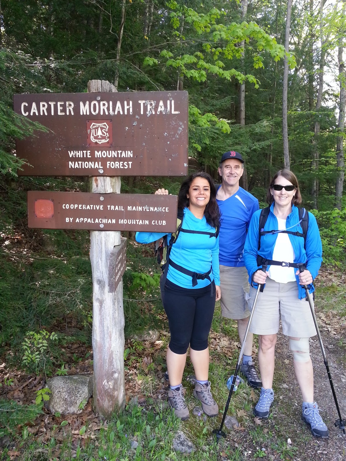
We chose Mt. Moriah located in Gorham, NH for our first hike of this season.  On Saturday, May 18th, Paloma, my parents, and I left Bradford at around 6:45AM for a long ride up Route 16 to Gorham.  The weather was beautiful out - hardly any clouds in the sky and a mild 55-60 degrees.  The ride was rather uneventful, just the typical stop at Dunkin' Donuts to fuel up on coffee and a bathroom break.
Paloma, Dad, & Mom at the Trail

Since we only had one car, we decided to do an out-and-back on the Carter-Moriah trail.  The total trip being nine miles.  We arrived at the trail head at 9:30AM, and after taking our usual pre-hike photos at the trail head  began our hike at 9:40AM.  The trail head is located at the dead-end of a road with a number of houses along it.  There were a few cars in the lot and we began our hike just behind a pair of guys from Somerville, MA....small world.

Views to the Presidentials
The trail started off fairly steep, and really got our blood pumping.  The air was extremely crisp and the sun shining through the trees felt great - what a gorgeous day for a hike.  We held a pretty decent pace for the first mile or so, stopping only a couple of times for some of mom's famous trail-mix.  The first part of the trail was surprisingly void of rocks and roots, which was a welcomed change from the typical ankle-destroying trails that we are used.  After another half-hour or so we began hiking through a primarily pine forest and emerged onto the side of Mt. Surprise, where we were treated to amazing views of the Presidential Range.  The entire side of Mt. Surprise is a series of open rock ledges.  Thankfully this part of the trail was dry, as I would imagine it would be very difficult to hike up in the snow or rain.

Log Bridges
Looking out towards the Presidential Range instantly brought back the memories I had from our hiking trips last summer.  These were some of the best views of the Presidential Range I have ever been treated to.  The absence of clouds made them stick out tremendously against the blue skies.  The tops of nearly all of the mountains still had a decent amount of snow.  After taking in the views, we continued on our way.

After getting back in to the more wooded section of the trail, I saw a tiny patch of snow hiding in between two giant rocks.  I thought it was pretty amazing as I was here sweating in nothing but a t shirt and shorts, yet there was still snow on the ground.  Little did I know that this tiny patch of snow was foreshadowing what was to come.  We passed a few different people hiking along the way, everyone expressing how beautiful the day was.  At some point we had summitted, then began descending from, Mt Surprise   I am guessing that is why it is called Mt. Surprise, because it felt as though the mountain exclaimed, "Surprise! You will have no clue that you just hiked over me."  After a short downhill we began a steep ascent to the summit of Moriah.

SNOW!
The ground turned fairly moist at this point, and very muddy sections required us to take more care with our steps.  Thankfully the trail crew had installed log bridges over the muddiest spots.  As we ascended higher, the temperature began cooling down even more and small patches of snow began to appear.  Those small patches quickly turned into bigger patches, and soon we found ourselves hiking through a snow covered trail for the remainder of the ascent.  It was a cool experience (no pun intended) hiking through the snow, but the warm weather made it quite treacherous as every so often your feet would break through the hardened top of the snow and drop in knee-deep.  I now know why most winter hikers use snowshoes and micro-spikes during the snowy season.

Regardless, it added a new challenge and made the hike that more memorable.  A short while longer and we reached a split in the trail, with a sign pointing towards the summit of Moriah.  A minute later we emerged to the top, meeting with the two guys who we had met at the trail head and another couple.  The time was 1:05PM. The summit of Moriah was awesome.  It was almost as though someone had stuck a huge boulder at the top which acted as a lookout tower.  We had 360 degree views and the beautiful weather allowed us to see for miles in each direction.  We decided to sit and have lunch, looking out towards the Presidential Range the entire time.  What a reward!  It was a bit chilly at the top so we all put on our jackets.

At the Summit
After soaking in the views and some sun at the summit, we began our descent at 1:40PM.  The descent turned out to be a bit more difficult than the ascent, as the snow slowed us down quite a bit - we didn't want to slip!  Luckily we didn't experience any injuries, and made it back to the trail head at 5:20PM, completing our first 4000' of the season.  This was a great hike!  We were all pretty hungry so we decided to stop in North Conway for dinner at the Muddy Moose on the way home.  After dinner we grabbed some dessert at Dairy Queen (my personal favorite), and headed home.

Paloma and I at the summit
I am grateful that Paloma and I decided to stop being lazy and start going to the gym more often, as it certainly paid off on the trails.  Paloma handled the trail with ease and I felt much stronger than last season.  I still woke up quite sore the next morning - but hey, no pain, no gain - right?

I highly recommend this hike to everyone.  The views are fantastic and the terrain is quite varied.  The hike is on the longer side but the views at the top are worth it!

Hike Stats
Trails: Carter-Moriah Trail
Total Time (Including Breaks): 7:40
Distance: 9.0 Miles
Elevation Gain: 3550'