Showing posts with label Mountain. Show all posts

Monday, June 1, 2015

South Carter - 4430' Middle Carter - 4610' (36/48)

Trail-head
Exactly one week after our hike up Carter Dome, Paloma and I wanted to finish the other two Carters – Middle and South Carter.  In retrospect, we should have tackled these two when hiking Carter Dome, but alas, any day hiking is a good day so we didn’t mind the extra trip up.  Plus, my parents decided to join us for their first hike of the year.  We met up at the Park-N-Ride in Newburyport so that we could carpool.  The ride up Rt. 16 was pretty uneventful as usual, and I was able to relax a bit after volunteering at a beer festival the night before.

We arrived at the Nineteen Mile Brook trail-head at approximately 9:15AM, made our final preparations, and were on the trail at 9:34AM.  Our route for the day was a 10.8 mile loop up the Nineteen Mile Brook and Carter Dome trails to Zeta Pass, then along the Carter-Moriah trail over both summits, before finally descending by the North Carter and Imp trails back to Rt. 16.  Per usual, the Nineteen Mile Brook trail provided a nice warm up to the hike and we finished this section relatively quickly.  It was stunning how different the temperatures were from the previous weekend, as during that hike I was wearing a jacket and quite chilly yet was already dripping sweat on this hike by the time we reached the junction with the Carter Dome trail.

Summit of South Carter
The Carter Dome trail was a bit steeper than the Nineteen Mile Brook trail so we took it pretty easy, knowing that we had quite a bit of mileage in front of us still.  The trail gains elevation quite quickly through a series of switchbacks, but never really hits any extremely steep grades.  That being said, the humidity was catching up to us and we were all sweaty.  Unfortunately, any time we stopped to take a breather we were met with an onslaught of black flies and mosquitoes.  There is nothing worse than black flies when hiking.  Nothing!

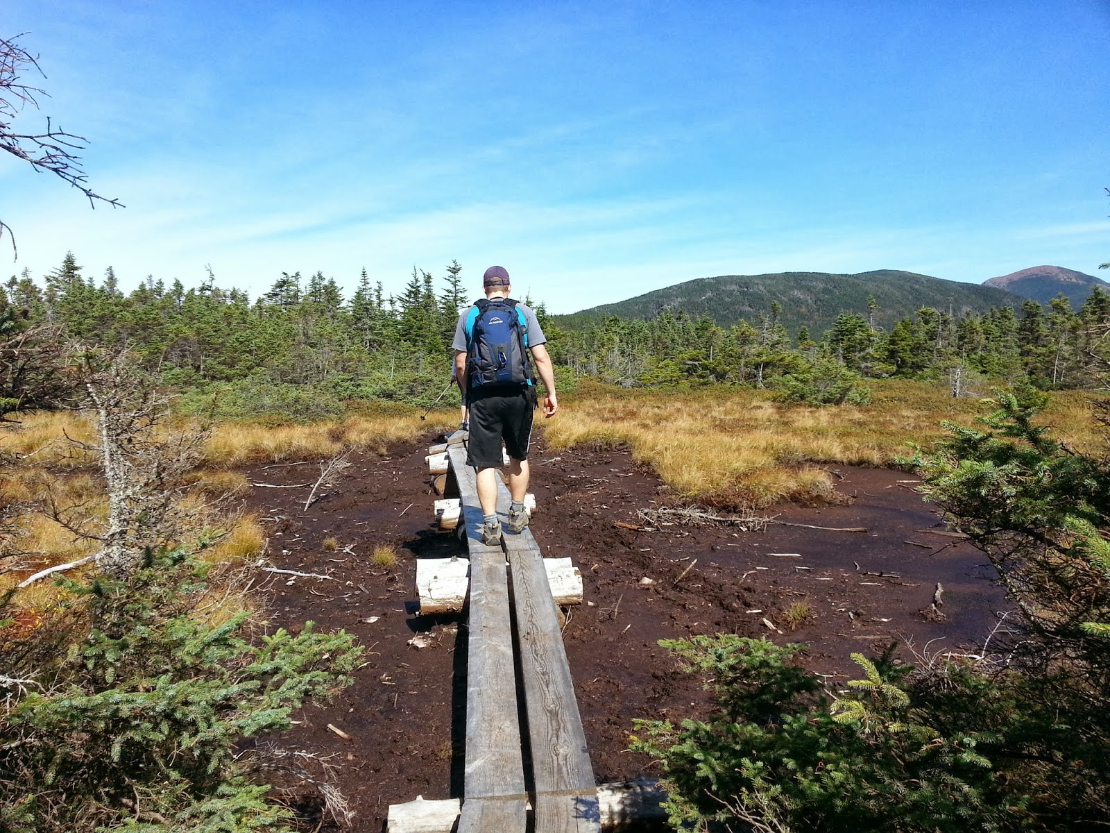
We reached Zeta Pass at 12:25PM and chatted for a bit with a guy named Doug and his daughter Amy who were sitting down cooking some Ramen Noodles on a camp stove to the side of the trail.  Boy, did that little 50 cent package of Ramen look delicious!  We chatted for a few minutes before heading over to bag the summit of South Carter.  The going across the ridge was pretty easy with a few small PUDs along the way (pointless ups and downs), and there was still a couple piles of snow surviving the heat along the side of the trail.  A series of man-made bridges help us navigate the muddy sections and before we knew it we were at the summit of South Carter. 

Mom and Dad
It was 1:00PM on the dot and we were all hungry so we decided to hunker down and eat lunch and enjoy the views (or lack thereof…).  Seriously, the summit of South Carter is just a cairn in the middle of the woods – pretty unmemorable.  Once we sat down we were again bombarded by all sorts of flying insects – I guess it was lunchtime for them too.  We wolfed down our sandwiches, cookies, and some chips and decided to get out of there before we were fully consumed by the bugs.  We began the trek over to Middle Carter at 1:11PM.  Given the humidity I was nearly out of water already, which was impressive since I carried 3L of water to start the day.  Guess the beer festival the night before made me thirsty!

Again, the going across the ridge was pretty easy.  There were some sections of low lying brush which afforded us some pretty nice views, even though it was a bit cloudy out.  The breeze in these sections helped to keep the bugs at bay which was nice as well.  We reached the summit of Middle Carter at 2:02 PM – again, another pile of rocks in the woods.  At least here there was a little lookout point which had some pretty nice views from it.  Since we had already ate lunch we pretty much just took a few photos and continued on our way down.  Shortly into our descent we passed a couple people who warned us of a “crazy bird” that had been attacking people that afternoon on the trail.  Some sort of grouse or something.  I was actually hoping that we would run into it to see what all the fuss was about but we never had the pleasure.
Summit of Middle Carter

We reached the junction with the North Carter trail at 2:34PM and after just a few minutes we were hiking down the middle of a small riverbed.  This was interesting.  There weren’t any visible trail markings so we took a few minutes to look at the map.  I was convinced we were on the trail but it was in pretty rough shape.  The trail was extremely narrow and soaking wet with a few blown down trees.  Fun.  We finally began to see some footprints in the mud and realized we were, in fact, on the correct trial.  It took us nearly an hour to get down to the junction with the Imp trail, reaching it at 3:23PM.  Only a little over three miles were left!  At this point Paloma and I decided to take off ahead on our own as someone was going to have to hike or get a ride 1.5 miles back up Rt. 16 to retrieve our car from the parking lot since this route didn’t end at our starting point.  We figured we could cruise down, walk or grab a ride, and make it back by the time my parents were finishing.

Paloma and I at the lookout
The Imp trail, while consistently downhill, seemed to be filled with pointy and loose rocks, making it a bit difficult to go down as fast as we wanted to.  Usually we try a light jog on the descent at points but trying that here would have been irresponsible and dangerous.  We were still able to keep a good pace but with both of our waters empty and our feet starting to hurt, it wasn’t effortless!  The Imp trail taunts you a bit because you nearly get to Rt. 16 before it turns and skirts parallel alongside it.  You can hear cars but can’t see them or reach any parking lots!  We ended up passing Doug and Amy on the way down, but they caught back up to us when we stopped to determine if we could bushwhack back to the car instead of continuing on the trail.  Rather than bushwhacking, Doug offered us a ride back to our car so we decided to hike the rest with him and his daughter.  We spent the last mile or so chatting about hiking, recounting stories from our more memorable hikes.  It made the time go by very quickly.

Cloudy but beautiful!
We reached Rt. 16 at 4:44PM and followed Doug and Amy for about a quarter mile on the road to their car and they dropped Paloma and I at our car.  What nice people you sometimes meet on the trail!  Paloma and I shed our boots and drove back to where we finished the hike to wait for my parents.  It felt great to change into new clothes and clean ourselves up a bit!  My parents came out of the woods at about 5:15PM, exhausted.  A good meal was earned by all of us, so after my parents had a chance to clean up a bit we headed to the Red Fox for a delicious dinner!

All-in-all this was a decent hike but not one I would recommend if you are looking for views.  I do enjoy the Nineteen Mile Brook trail so that is a plus.

Hike Stats
Trails: Nineteen Mile Brook, Carter Dome, Carter-Moriah, North Carter, Imp
Total Time (Including Breaks): 7:10
Distance: 10.8 Miles
Elevation Gain: 3,500'

Sunday, June 29, 2014

Wildcat Mountain (A Peak) - 4422' Wildcat Mountain (D Peak) - 4050' (28/48)

Wildcat Ridge Trail Head
After what seemed like an eternity, my foot was finally feeling strong enough to test out on the trails.  The great weather we have been having lately had my mind on the mountains, and I was happy to finally get back to hiking!  It had only been a little over two months since I broke my foot on a hike up Mt. Cabot, but those two months seemed quite long!  My foot actually healed up quite well - and ahead of schedule - so I was confident that I would be okay hiking on it.  I was getting tired of seeing pictures and reading blogs about other people out there enjoying the trails....my turn!

Paloma, my parents, and I decided to hike the Wildcats on Saturday.  Out of all the mountains in New Hampshire, I have probably spent the most time on Wildcat, skiing.  I love skiing on Wildcat because it is one of the less crowded ski areas and the views on a blue-bird ski day across to Washington are nearly unrivaled.  Needless to say, I was happy to to be spending some more time on the mountain, this time for hiking.  While most of our skiing is done on Wildcat (D Peak), the Wildcats are actually a set of 5 different peaks, uniquely named A, B, C, D, and E.  Unfortunately, due to 4000 footer rules, only peaks A and D count towards the list, though the route we had planned would take us across all five anyways.

Crossing the River
We headed up Route 16 towards the Glen Ellis Falls parking lot, located a few miles south of the Pinkham Notch visitors center, arriving at approximately 8:40AM.  The lot was relatively empty when we arrived, but as we made our preparations for the hike it slowly began to fill up.  The weather forecast was looking great - a mild 70 degrees with only a few clouds in the skies.  We officially set out on the Wildcat Ridge trail at 9:00AM.  The trail begins by heading underneath Route 16 through a man-made tunnel, and immediately crosses the quite active and deep Ellis River.  The river was a bit difficult to cross so it took a few minutes for us to successfully navigate to the other side.  Immediately after the river the trail begins a steady and quite rocky climb, which awarded us with excellent views of Mount Washington after only about twenty minutes on the trail.  The trail continued to skirt alongside some open rock faces for a while and continued climbing steadily - at no point is the trail flat.  What a great way to whip my ass back into shape!
Steep Climb!

At some point we had summitted Wildcat E Peak, but given the absence of any type of markings, where exactly that was, I am not so sure. Just before we reached Wildcat D Peak (one of the ones that counts), we came into a clearing at the top of the Wildcat Gondola chair.  Wow, this looks a lot different in the winter!  Much like Cannon Mountain, Wildcat tends to attract summertime tourists who can easily get great views of Mt. Washington and the Presidential Range by simply taking a five minute Gondola ride to the top.  Yuck!  It made me feel great though to see a guy walking by with flip flops on reaking of Armani cologne while I was covered in mud reaking of MAN.  Oh well.  We took a few photos and continued up the short incline to the summit of Wildcat D Peak, reaching it at just about 11:30AM.  After taking a few photos from the wooden lookout tower, we continued on our way.  There were a few trails leading from the top of Wildcat D Peak, so we spent a few seconds trying to figure out the right one.  Luckily we chose correctly (if looking at the stairs, the trail is to the right), and began making our way across the ridge to Wildcat C Peak.

Top of the Gondola
The going across the ridge was actually a lot more strenuous than I had anticipated.  You descend and ascend quite a bit over the mile or so to Wildcat C Peak, which took a lot of our energy.  Given that we only had one car, our plan had been to do an out and back on the Wildcat Ridge trail, but the up and downs were not going to be easy on the way back so we modified our plan and decided to continue across all of the peaks and descend via the Nineteen Mile Brook trail (wise choice!).    Unfortunately, the parking lot that this trail takes you to is located about five miles from where our car was parked, so one of us would need to walk or hitchhike back to the car and return to pick up the others.

Summit of Wildcat D Peak
Much like Wildcat E Peak, we weren't quite sure exactly when we hit the summit of Wildcat C or B peak, but were able to estimate it pretty good.  We reached Wildcat A Peak at 1:20PM, and sat down on a beautiful ledge overlooking Carter Notch and the Carter Notch Hut for lunch.  We watched some other hikes way across the Notch while we ate.  Luckily, there weren't many people on the outlook, only a couple of guys who joined us halfway through lunch.  They too, modified there plans and actually had a friend giving them a ride back to the Glen Ellis Falls parking lot, so my mom bribed them with some fresh bing cherries for a ride back as well if we were to end up at the lot at the same time.  We finished lunch and began the descent to the Nineteen Mile Brook trail at 1:40PM.

Summit of Wildcat A Peak
The descent was quite steep to start, but once we reached the junction with the Nineteen Mile Brook trail it flattened out quite a bit.  Knowing that we weren't going to have to deal with the up and downs on the Wildcat Ridge trail was quite settling.  We kept a pretty quick pace going down, and the descent was relatively uneventful, but the trail was actually quite pretty at some parts where it weaved alongside a fairly rapid river.  About a half mile from the parking lot we encountered an older gentleman walking up the trail.  He indicated to my dad that he was just hiking up to meet some people on the way down.  We didn't put two and two together that he was the person giving the two guys we met at the top a ride back to the Glen Ellis Falls parking lot.  Whoops!

My Cool Parents!
Needless to say, we got down to the lot before the two guys and their ride, so I jumped at the opportunity to hitchhike back to the lot some five miles away (call it a bucket-list item).  My father decided to join, and before you know it we were walking up Rte. 16, thumbs stretched out.  A few cars passed by without stopping, but shortly into our walk a pickup truck with an older man and two kids pulled over onto the gravel shoulder - we told them where we were headed and they obliged. My father and I hopped into the bed of the pickup and off we went.  Thank god we got picked up because this five miles had a pretty steady incline at a few points - which frankly would have sucked after our long hike!  We got back to the lot, gave the guy a five-spot for his hospitality, hopped in our car and went back to pick up Paloma and my mom.  Success!

We were all pretty hungry so we decided to stop at the Moat Mountain Smokehouse for dinner.  Aside from the families with one trillion starving kids who just got out of a day at Story Land, the dinner was quite tasty and the beer even tastier.  All in all a solid hike!

Hike Stats
Trails: Wildcat Ridge Trail, Nineteen Mile Brook Trail
Total Time (Including Breaks): 7:20
Distance: 8.7
Elevation Gain: 3,150'

Monday, October 21, 2013

Mt. Garfield - 4500' (24/48)

Paloma and I at the Trail Head
This past weekend we decided to hike Mt. Garfield.  I had been reading that this was a pretty mild hike with great views from the summit - sounded perfect for a brisk fall day.  My parents picked up Paloma and I at around 6:30AM and we set off for the trail-head, arriving at 8:45AM.  My Uncle Ken and Aunt Martha decided to join us, so we met up with them at the parking lot.  The weather was quite chilly, approximately 45 degrees at the base.  As we were getting our gear together we could see our breath, though the clear skies and shining sun gave promise that it would warm up.  I put on my new Icebreaker Merino Wool shirt as a base-layer so I knew I was going to be just fine.

Dad crossing the Gale River
The Mt. Garfield trail-head begins from a small parking area about a mile down a gravel road off of Route 302.  It is nice to be removed that far from the main road as it was nearly perfectly silent in the woods.  There were a few other cars in the parking lot but nothing compared to some of the lots we drove by back in Franconia Notch.  We started up the Mt. Garfield trail at 8:58AM.  The trail started climbing right from the lot along a forested ridge, following alongside the Gale River.  The trail at this point was in pretty good shape, though the piles of fallen leaves required you to be a bit careful on some sections, as hidden rocks and roots could easily trip you up.

The crew at the junction
The trail then took a left and we began hiking along an old fire-road.  This was nice because the trail was pretty wide and maintained a pretty moderate grade for the next few miles.  We spent the majority of the hike up talking and joking, so the miles went by fairly quickly.  We passed only a few other hikers along the way which was a nice change from the droves of people hiking on the Kinsmans the week prior.  The absence of noise from cars, other people, and wind made the trail especially peaceful.  While the Mt. Garfield trail doesn't offer many views while hiking up, the red, orange, and yellow leaves made it quite beautiful.  A bit further up we came into a primarily birch tree covered section of the trail which offered a stark contrast to the colorful other trees that we had just hiked through.  Come to find out, this particular section is actually called the "Burnt Knoll" as it was once completely burnt out, and the birch trees grew back in.

Paloma at the Summit
We reached the junction with the Garfield Ridge Trail shortly thereafter.  At this point, Ken and Martha decided to head back down, as they were in a rush to get back to let their dog outside.  After a few snacks we said our goodbyes, and Paloma, my parents and I continued the hike up to the summit, .2 miles ahead.  From the junction to the summit is the only remotely challenging portion of the trail.  It was actually quite steep in a few sections.  Though being only .2 miles, it didn't really challenge us too much.  Before you knew it we emerged from the trees to the beautiful summit of Mt. Garfield at 11:40AM.  The summit is primarily bare, with an old fire tower foundation at the very top.  I of course decided to climb around in the foundation and sat on one of the old walls.  The views were incredible - you could see in every direction.  It was interesting to look over at the backside of the Franconia Ridge Mountains (Lafayette, Lincoln, etc.).

Summit of Mt. Garfield
We sat down on a rock outcrop to have lunch and take some more photos.  I explored around the summit and came across another American Flag tribute to a fallen NH soldier, the second one I have encountered.  I really like what this guy is doing.  We finished up lunch, took a few more photos, and began to head back down at 12:08PM.  We knew from the start that the descent was going to be a quick one, and we welcomed this since Paloma had plans in Boston that she needed to get back for.  Given that the grades on the trail were moderate, the hike down  felt extremely fast.  We arrived back at the parking lot at 2:17PM and headed back to our place.

All in all this was a great hike.  I definitely recommend this for anyone looking to get in some decent mileage but not be killed by difficult terrain.  While there was nothing too significant about the trail, it was still quite beautiful.  The summit is one of the best I have been on which more than makes up for the "boring" trail.  It was nice to hike with Ken and Martha as this was the first time I have done so - I would like to hike with them again in the future!

Hike Stats
Trails: Mt. Garfield Trail
Total Time (Including Breaks): 5:20
Distance: 10 Miles
Elevation Gain: 3000'

Sunday, September 22, 2013

Mt. Jackson - 4052' Mt. Pierce - 4310' (23/48)

Webster-Jackson trailhead.
The forecast was looking great for Saturday, so Paloma, my mother, and my father decided to head up north to do another hike.  We chose Jackson and Pierce, the two southern-most mountains of the Presidential Range.  The ride up was relatively uneventful, save for the routine stop at Dunks for a morning cup o' coffee. This time of year is my absolute favorite time for hiking - mild to cool temperatures, beautiful scenery with the leaves beginning to change, minimal bugs, and typically less traffic on the trails.  Plus, you have all day on Sunday to recover with some football.  Needless to say, I was a little bit extra excited for this hike.

Summit of Mt. Jackson
We arrived at the trail head at 9:00AM on the dot, gathered our gear, laced up our boots, and were on our way at 9:10AM.  The route we chose was a loop using the Webster-Jackson, Webster Cliffs, and Crawford path trails, summiting Jackson first then Pierce.  Just over 8 miles round trip.  The beginning part of the Webster-Jackson trail starts gaining elevation right off the bat, but nothing too difficult.  We all couldn't believe how beautiful the weather was.  Cool enough that you didn't sweat much but warm enough to hike in only shorts and a short-sleeve shirt.  There were a number of small streams that we had to cross along the way, none causing any issues.  As we approached closer to the summit of Jackson, we were treated to some great views through the trees - foreshadowing the beautiful views we were about to see at the summit.

Feeding the jays
We reached the summit of Jackson at 11:10AM.  To say that it was beautiful at the summit is a gross understatement.  It was gorgeous.  The summit of Jackson has very few trees, mostly just small brush and alpine flowers.  The summit is fairly large so you can walk to different sides of it for views in all directions.  Perhaps the best view is across to Mt. Washington - where you can easily see the majority of the Presidential Range, including Mt. Pierce, where we were headed next.  It was a bit too early for lunch so we decided to just have some snacks at the summit.  About one minute after opening the bag of trail-mix, a pair of gray jays came swooping into the bushes next to us, ready for a meal.  These little buggers are not shy one bit, and within seconds they were eating cheerios and peanuts out of our hands.  It made for some very cool photos, especially with the beautiful views surrounding us.  Not wanting to give all of our snacks away, we packed up and decided to head over to Pierce, leaving the summit of Jackson at 11:25AM.

Swamp crossings
Though a decent distance, the hike over to Mt. Pierce was quite easy.  At many points the trail crossed some swampy areas with man-made foot bridges, otherwise the majority of the traverse was relatively flat, with only a few sections that got your heart rate going.  We were told that the final approach to Pierce was a bit steeper so it made sense that this section was not.  At about .9 miles from the summit of Pierce we reached the Mizpah Spring Hut, an Appalachian Mountain Club owned-hut.  It was 12:20PM.  We stopped inside to check it out.  There were a few others inside eating lunch, relaxing, and enjoying the beautiful views from the oversized windows.  I saw the menu for those staying over for the evening - a delicious sounding turkey dinner....wish I was staying!  For some reason I am intrigued by the various huts scattered throughout the White Mountains - Paloma and I will definitely be putting my AMC membership to use next hiking season and plan on staying at a few of them.  After a few minutes, we refilled our water bottles and headed out for the final push to the summit of Pierce.

Approaching the Mizpah Spring Hut
Along the way we came across two guys, a young boy, and perhaps the largest, bleach white dog I have ever seen.  For a second I thought we had come across a polar bear.  The dog was carrying his own pack of food and looked to be enjoying the hike greatly.  This section of the trail was quite a bit steeper than the traverse, and there were numerous spots where you had to use your hands to climb up man-made wooden steps over the steep rock faces.  We emerged from the trees and reached the summit of Mt. Pierce at 1:05PM.  Once again, we were treated with truly amazing views.  We also, unfortunately, were treated with quite a bit of wind.  We decided to snap a few photos but head down into some tree coverage to eat lunch.  We were again joined by some grey jays looking for handouts, and had fun feeding them some crumbs from our food.  Let's just say, I think my family has become legendary within the grey jay community.

Summit of Mt. Pierce
I did want to point out something that we saw at the summit of Mt. Pierce that I thought was very admirable and thoughtful.  Right near the cairn at the top was a small American flag with a laminated note card attached to it.  On one side of the note card was a photo and short profile of a New Hampshire native who was killed in action in Baghdad during Operation Iraqi Freedom.  On the reverse side was a note from the individual who placed it there, a New Hampshire native who is a disabled war veteran.  He is attempting to hike all 48 four thousand footers and at the summit of each one, will be placing one of these cards profiling a different NH native who died in combat.  What a great way to remember these folks.

Summit Memorial
After we ate our lunch we began the descent down the Crawford Path towards the car, beginning the descent at 1:47PM.  The Crawford Path, though rocky, is quite moderate in pitch, so we were cruising pretty quickly down towards the car.  The moderate decline made it much easier on the knees as well.  As we got closer to the bottom, we decided to take a short spur off the trail to check out Gibbs Falls, a small waterfall with a few rocks to sit on and enjoy the beauty.  We took a couple of photos and headed back down, reaching the road at 3:17PM.  The trailhead we parked at was about a quarter of a mile down the road from where we ended, so we had to walk for a few minutes along the road to get the car.

On the drive home, we decided to stop for dinner with my grandparents in Concord, NH.  My father had two gift cards to the Longhorn Steakhouse, so we made the logical decision to go there.  I wolfed down a nice 14oz. sirloin and a delicious sweet potato, washing it down with an Oktoberfest.  Solid post-hike meal.

Overall this hike is relatively easy, but offers some amazing views and nice terrain.  I highly recommend this to everyone, and it is certainly a hike that I will revisit in the future.

Hike Stats
Trails: Webster-Jackson, Webster Cliff, Crawford Path
Total Time (Including Breaks): 6:00
Distance: 8.3 Miles
Elevation Gain: 2650'

Friday, August 2, 2013

Preparing for My First Bushwhack - Wolf Cub - 8.3.13

It has been a few weeks since my last hike - been very busy lately!  Paloma is away in Sao Paolo, Brazil for two weeks for work, so I decided to sign up for my first ever trip through the AMC - Boston Chapter - a 12+ mile bushwhack of Wolf Cub, a 3000' mountain located close to Lincoln, NH.  A bushwhack means that there are no formal trails leading to the summit, so we will be using a map, compass, and brute force to move through thick woods/brush to our destination.  I couldn't be more excited!  We might even try to tackle the slightly more popular Mt. Wolf - this is all depending on energy levels and interests of the others in the group.  It looks like there will be approximately 6 or so others doing the hike with me.  I have not met any of the others but just knowing the type of people who tend to enjoy hiking, I am sure they will all be great.

Topographic Map of Wolf Cub
Though I have spent plenty of time exploring the woods off-trail - I have never done this with a particular destination in mind.  Luckily, one of the guys I am hiking with is experienced with land navigation and has offered to help me get my bearings once we are underway.  I was able to scrounge together some old "bushwhacking" gear (see below), including some old gators to help protect my legs if we are pushing through thorns/brush and some clear lensed glasses to protect my eyes from sticks etc. in the dark woods.

I am confident in my fitness level at this point so I am not too worried about that aspect of the hike - though I think it will be more challenging than I am anticipating given that we are hiking through non-maintained woods. It will sure be an adventure, one that I can't wait to write about when I finish it!

The below is some of the gear that I am bringing along on the hike.  Much of this I would typically carry anyways, but bushwhacking requires some additional items.

Gear
1. Hat to protect from branches.
2. Gators to protect my legs.
3. Gloves to use if I need to remove brush from the path.
4. Headlamp in the event that we take longer than planned.
5. Clear lenses to protect my eyes in the darker woods.
6. First-aid.
7. TP for, well, pooping.
8. Hand-sanitizer for after #7.
9. Goldbond - miracle for every sweaty male.
10. Lighter.
11. Knife to kill attacking bears.
12. Compass for navigation purposes.
13. Plenty of protein/energy bars.
14. 100 Oz's of water.
15. Rain jacket for bad weather.
16. Not pictured - other food, boots, pack,
extra clothes.

Check back in a few more days for a detailed report of this trip!

Sunday, July 14, 2013

Mt. Flume - 4328' & Mt. Liberty - 4459' (17/48)

Choosing the Slide
Paloma and I planned a last minute trip up to the White Mountains for the weekend to get away for her 25th birthday.  We decided to hike Flume and Mt. Liberty on Saturday, so we set off from our place at about 6:45AM for the ride up 93 to the trail-head.  We had a bit of difficulty finding the trail-head, so we stopped at the Flume Gorge visitors center to ask.  The first thing to come out of the park ranger's mouth was "You sure you know what you are getting yourselves into with the Flume, correct?"  Me, not wanting to seem like a pansy, brushed his question off assuring him we knew what we were about to do.  We left and drove a few hundred feet up the road to the trail-head. The parking lot was already filling up - looked like many people decided to take advantage of the nice weather and hike.  We officially started our hike 9:15AM.

Scaling the slides
The first mile or so of the hike was quite easy, part of it following along on a paved bike path.  This was a nice way to get our legs warmed up.  We reached the junction where we had to choose between taking the Liberty Springs trail or the Flume Slide trail.  Prior to this hike I had done some research which said to avoid the slides if possible, and to never, ever try to descend them.  Well, I wasn't going to do this hike without experiencing the challenge of the slide on the ascent, so we chose the Flume Slide trail.  We began the trek over to the base of the slide.  At this point, the trail followed and crossed a river many different times, which added some nice variety (read: mud) to the terrain.  We did our best to conserve our energy on this section, as we knew what lay ahead.  We only encountered a few other people as we heading towards the slide.

Paloma dominating the slides!
When we reached the base of the slide, two different groups who had been ahead of us had stopped to fuel up on sandwiches, water, and energy bars before tackling the slide.  Paloma and I had been hydrating and eating "on the run," so we blew right by them.  The first part of the Flume Slide was fairly steep, though nothing that gave us much trouble.  The rocks were quite loose so you had to take care where you stepped.  As we climbed higher, the rocks increased in size, and streams of water seemed to be flowing from all over, drenching the rocks and turning them into dangerous obstacles.  "Only 1.2 miles of this", we thought to ourselves.  By this point, the challenge of the climb allowed the two other groups time to catch up, and we all  continued climbing up together.

Summit of Flume
Wow, this was intense.  I now understood what the park ranger had meant.  Paloma and I helped each other  scale the rock faces, knowing that one false move would likely lead to multiple injuries.  Our legs burned and our clothing was drenched with sweat, mud, water, and more sweat.  Once we thought that the slides were done, another, more difficult section followed.  We took our time and slowly but surely made our way to the end of the slides.  Little did we know, there was still quite a bit of hiking left before we would finally reach the summit.

View over to Liberty
The amount of energy and strength that it took to tackle the slides made the remainder of the ascent to the summit of Flume quite tiring.  I was certain I had sucked down nearly all of my water on the slides, and my stomach was begging for food.  We finally broke through the trees and were treated to spectacular views and stunning cliffs.  "Ahhhh" we both said, this is why we just tortured ourselves on the climb.  We hiked along the cliffs and reached the summit of Flume at 12:50PM.  Perfect time for lunch.  There were a few other couples at the top, and we spent some time talking with one couple (after I noticed his Heady-Topper beer sticker).  We took photos for one-another.  Another woman at the top had just finished her 41st peak - impressive.  From the summit of Flume we could see over to Liberty - it looked quite far but the food, rest, and beautiful views got us excited for the next part of our hike.  We left the summit of Flume at 1:18PM and began the hike across Franconia ridge to Mt. Liberty.

Summit of Mt. Liberty
Compared to what we had just hiked through, the hike over to Liberty wasn't especially challenging.  Regardless, we were both breathing heavy when we began the ascent up to the summit.  We had heard (and read) that the views from the top of Liberty were even better than the views on Flume - that notion gave us the final motivation to push for the summit.  We reached the summit of Mt. Liberty at 2:06PM.  Time for another break - almonds and fruit, just what we needed to stabilize our energy levels.  As we were sitting at the top, admiring the gorgeous 360 degree views, two guys and a girl emerged on the summit.  I immediately recognized the girl, and sure enough, as they approached, I realized that it was Amanda Walke - a friend from Danvers!  What a small world!  This was her first hike - and dang, she picked a good one.  We talked for a bit and then split ways.  After taking more photos, Paloma and I decided that it was time to begin the descent down the Liberty Springs trail at 2:27PM.

View back to the Flume
We kept a very fast pace on the descent.  On the descent we passed through the Liberty Springs camp sites - which I would love to camp at on a future hike.  The descent was relatively uneventful but quite muddy, so we were
both slipping and sliding.  We leapfrogged with Amanda's group a few times, and finally decided to hike as a big group for the remaining mile or so.  By the time we reached the Whitehouse trail and bike-path again, my legs had had it.  I was cooked!  We made it back to the car at 4:39PM, shed our nasty boots and socks, and hopped in the car.

Sunset at dinner!
While we would typically have a 2+ hour car ride to deal with after a hike, Paloma and I had decided to rent a cheap motel room for her birthday.  It just so happened that it was literally 3 minutes from the trail-head.  Score.  We checked in, showered, guzzled some coffee to wake ourselves up, and got ready for dinner.  We weren't sure what we wanted to eat, so I spent some time on Yelp while Paloma got ready.  I decided on the Sunset Hill House Restaurant, and damn, was that a great decision.  The scenery from the restaurant was spectacular, looking out over a giant field with Franconia Ridge in the background.  We each had a 6 (yes, SIX!) course dinner in celebration of both Paloma's birthday and our completion of a strenuous hike.  The food and service was exceptional.  Paloma had a mixture of Shrimp and Scallops for her entree, and I had duck.  It was tremendous.  We had planned on going out to one of the local bars after to have some drinks, but by the time we finished dessert, we were both ready to hit the hay.  We were in bed and out by 9:30PM.  What a day!

Overall this was one of the more difficult hikes we have done, but the views, the challenge, and the views (yes, I added that twice - they are that good) made it all worthwhile.  I am not going to "recommend" the Flume Slide trail to anyone, as I don't want to be held responsible if injuries occur, but I will say that there is nothing quite like it!

Hike Stats
Trails: Whitehouse, Flume Slide, Franconia Ridge, Liberty Springs
Total Time (Including Breaks): 7:20
Distance: 9.8 Miles
Elevation Gain: 3700'

Thursday, May 9, 2013

Hiking Season is Here!

Finally!  The weather has been getting nicer, the snow has been melting, and I have been getting more and more excited each and every day.  Paloma and I have been working out quite a bit at the gym to make sure that we are in better shape for the start of this hiking season.  We have been frequent users of the "StairMaster" at the gym which will hopefully help us on some of the steep mountains we have on our agenda to climb this season.

Paloma bought me a Kindle for my birthday a few weeks ago and I have been reading "AWOL on the Appalachian Trail," a vivid account of the author's (David Miller) thru-hike on the Appalachian Trail.  I am about halfway through the book and I can't seem to put it down.  He does a great job at describing everything from the trail to his fellow hikers, feelings, etc.  It is just what I need to read to get me ready for the upcoming season.  Maybe someday I will have a chance to conquer the Appalachian Trail.  It is a really great book and I highly recommend it to everyone.

We have scheduled our first hike of the season for May 19th, where we will be setting of to hike Mt. Moriah way up on Rte. 16.  Paloma and I will be joined by my parents, and potentially Joe and Julie as well.  I am greatly looking forward to this hike, as are my parents, as they have never hiked Moriah.  The trail reports look like it should be free from snow, though I do anticipate it might be quite muddy up there.

I am excited to finally be able to get this blog back up and running.  By the looks of it, I will hopefully be able  to nail down fifteen or so more peaks this season!

Thanks for reading, more to come following the hike up Mt. Moriah!

Monday, January 28, 2013

Pray for warmer weather!

It has now been over four months since my last hike in the White Mountains.  I have not attempted to hike this winter and have been extremely busy on the weekends with the wedding coming up.  That being said, my parents bought Paloma, Joe, Julie, and I all brand new sleeping bags for this coming hiking season.  I can't wait to get on the trails this spring and do some over-nighters.

My parents also bought me an awesome book for Christmas called "Following Atticus" by Tom Ryan.  It is a non-fiction story about a man and his dog who hike together to complete all 48 of the 4000'+ mountains in NH.  I have only had time to read through a few chapters, but all of the discussions about hiking and the different trails they have been taking has me getting really excited for this coming hiking season.

I have also been trying to stay in shape by doing the Insanity workout with Paloma.  I admit, I have not been following the program as closely as I would like to, but regardless, I am in much better shape now than I was at this time last year.  I am hoping to knock off closer to twenty peaks this coming spring/summer/autumn.

I have been talking with my uncle quite a bit about his hiking adventures, and he is about to finish all 48 in the winter - I am impressed.  I imagine I will be doing quite a bit of hiking with him this coming season.

Sunday, September 2, 2012

Mt. Whiteface- 4020' & Mt. Passaconaway - 4043' (8/48)


Leaving the Ferncroft lot
What a way to start September!  A nice twelve mile round trip hike up Mt. Whiteface and Mt. Passaconaway!  Paloma, Joe, Julie, and I left Somerville at around 7:15AM on Saturday, September 1st, and met up with my parents along Rt. 93 in Salem, NH.  Our destination - Wonalancet, NH, to park in the Ferncroft parking lot and take the Blueberry Ledge Trail up to the summit of Whiteface, before taking the Rollins trail to the Dicey Mills trail to the top of Passaconaway and then down to the base.

The ride up 93 was uneventful, but once we got off 93 and drove through Sandwich, NH on 113/a, the scenery became beautiful.  Huge hills, massive farms, and gorgeous farm houses lined the roads all the way to the Ferncroft lot.  The Ferncroft lot is right off of a dirt road in the middle of a field.  By the time we arrived at the lot, it was a few minutes to 10:00AM, and the lot was already quite full.  We made our final preparations and left the lot at 10:10AM, beginning our long hike.
Steep Sections

I recently switched to a new (yet old) backpack which was considerably heavier than my usual day pack, so I spent the first 100 yards adjusting the straps and making it comfortable.  The weather was a beautiful seventy degrees and partly sunny.  I was siked.

We decided to take the Blueberry Ledges "cutoff" trail, which though the same distance as the standard route, offered a bit more exciting terrain and river views.  The first mile or so of the hike was very mild and we were keeping a good pace, until all of a sudden we came to an extremely steep, fifty or so meter "hill," that we had to scramble up.  That got the heart going!  After this first tough section, the trail evened out a bit, yet again, we came to a another steep spot.  This was even steeper than the first, and about triple the distance.  We were all a sweaty mess at the top of it and decided to eat some trail mix and drink some water for a bit to recover.  Wow, I wasn't expecting this!  On the ride up, my brother had mentioned that he read the hike we were doing was one of the tougher ones in the Whites - I was beginning to see why!
Enjoying the Views

After a few more steep sections, we came out into big open, flat, rock faces that offered us our first views.  It was beautiful.  Knowing that we had quite a long hike ahead of us, we took in the views rather quickly, fueled up with some Powerbars, and continued on the way.  I had read that there were some sections coming up that required you to literally scale rock ledges, so I was more than excited to continue on.  We finally broke through the trees, and officially entered the "scramble zone."
I was in danger...Yeah..

This was awesome.  In front of us were a series of rock ledges that we had to maneuver up.  This was what I was looking forward to.  Being somewhat of a thrill seeker, I clearly tried to avoid the "easy" way up these sections, and much to my mothers dismay, took some questionable routes (sorry, Ma!).  It was a lot of fun climbing around on the rocks, and the views were incredible.  This section quickly propelled Mt. Whiteface to the top of my list of favorite hikes.  We decided to eat lunch on one of the ledges, as we had read that the true summit of Whiteface was just a cairn in the middle of the woods.  We took a quick lunch and headed up the remainder of the way, reaching the summit of Whiteface at exactly 1:45PM.  Our sense of accomplishment was a bit clouded as we realized we still had a good eight miles to go, but we anticipated that the remainder of the hike would be relatively easy.  Boy, we were wrong!
Sorry, Mom!

Summit of Whiteface
The Rollins trail, which we took to get over to the Dicey Mills trail is a meandering, roller-coaster type trail that seems to go on forever.  It was a relatively easy two-and-a-half miles, but still took a while.  We reached the junction with the Dicey Mills trail, and began to head to the summit of Passaconaway.  "Not too bad, we will be up there in a few minutes," we all were saying.  WRONG.  We passed a few hikers who were descending, and all of them told us that there were some steep sections ahead.  This was an understatement. The approach to the summit of Passaconaway is a beast - especially after already hiking a long way.  The trail travels at about a seventy degree angle, and just when you think it is going to flatten, it takes a quick turn and ascends some more.  Brutal.  My legs were screaming for some reprieve, but deep down I knew we had to muster through this.  At 3:45PM, we had finally reached the summit of Mt. Passaconaway.

Summit of Passaconaway
You would think that after such a brutal, painfully steep approach, that the summit of Passaconaway would be covered with beautiful blonde Swedes waiting to give you a cocktail and a massage.  Perhaps an ice-cream parlor and a hot tub.  Nope.  The summit was nothing but a dead end trail in the middle of the trees.  No sign congratulating you, no view to take a picture of, not even a rock to sit on!  What a slap in the face.  Oh well, the hike up Whiteface was so nice that it more than made up for it.  Regardless, I am on a mission to hike all sixty-seven 4000's in New England, and this brought me one mountain closer to completion.

Paloma's Descending Skills
After spending all of one minute on the summit, we began our descent.  The first part of the descent was slow, as we were hiking back down the steep rocky sections of the climb up, but the remainder of the Dicey Mills trail was rather quick on the way down.  Along the way we came across a few campsites that people had set up for the night.  Some of them had nice fires going and you could smell the baked beans and hot dogs cooking.  It took all of my might to not walk into those camps, push the people aside, and devour their food like a savage beast.

A few hours into the descent, we came across a group of people camping who warned us that there was a huge fallen tree with a monster paper-wasp nest about a quarter of a mile ahead. Sweet.  Now we had to be super careful since Joe is allergic and none of us wanted to get stung.  I decided to play scout and took the lead, scrutinizing every downed tree for this legendary nest.  About three quarters of a mile in, we still didn't see anything.  Luckily, another hiker was coming up (to meet with the group that warned us), and told us that the nest was a few hundred yards ahead of us.  Boy was he right.  The rest of our party took the low road, bushwhacking through the trees, while I was an idiot and decided to get close to the nest to "inspect."  All of a sudden a huge wasp came bee-lining (no pun intended) straight for my face, and I ran like a little schoolgirl one hundred yards back up the trail.  At that point, I too, decided to take the low road.

The Nest
About another quarter of a mile down the trail, we broke through the trees and began walking across the property of someones beautiful country farmhouse towards the car.  This area was absolutely gorgeous.  It made me honestly consider dropping everything to move out there.  We made it back to the car at 6:30PM.  No bee stings, no broken bones, but lots of blisters, sore muscles, and stench.  This was a beast of a hike, but nonetheless it was awesome!

Beautiful Finish to the Hike
We freshened up a bit, and headed back home.  Along the way we stopped at a Chili's for dinner since it was too late to go home and cook, where we had a few beers and some mediocre food.  Mom and I both got corn on the cob as a side, and let me tell you, Chili's makes the absolute worst corn on the cob.  In general, veggies are pretty hard to mess up, but Chili's consistently produces this soggy, chewy, golden devil that I would feel bad feeding to an animal, let alone a human.

Anyways, in summary, I highly recommend this hike to everyone who is looking to put themselves through some punishment.  The views and rocky sections of Whiteface make it all worth it!

Hike Stats
Trails: Blueberry Ledge, Dicey Mills, Rollins
Total Time (Including Breaks): 8:15
Distance: 11.9 Miles
Elevation Gain: 3800'


Monday, August 20, 2012

Mt. Waumbek - 4006' (6/48)

Starr King Trail-head
Less than a week after our trip up Mt. Carrigain, Paloma and I wanted to do an easy hike.  My parents, Joe, and Julie decided to join.  We chose Mt. Waumbek, one of the easiest of the 4000's, located in the Pliny Range in Northern New Hampshire.  Paloma and I rode with my parents on the way up, Joe and Julie followed.  The ride was quite long but very easy, straight up Rte. 93.

Moss
We arrived at the trail head at around 10:10AM, and began preparing for our hike.  The parking lot was tiny so we had to get a bit creative with where we parked, but this was a good sign because it didn't look like the trails would be too busy.  The temperature was absolutely perfect - crisp, cool air.  We planned on doing an out and back, taking the Starr King Trail over the summit of Mt. Starr King, to the summit of Mt. Waumbek and back.  We began the 7.2 mile trip at 10:30AM.

Summit of Mt. Starr King
The lower part of the Starr King Trail is on an old logging road which follows alongside a river for the first half mile, and is relatively easy.  We passed a few groups of hikers as we made our way up.  It was interesting to see how the scenery changed so quickly on the hike up.  At first we were in a hardwood forest, then a coniferous one, and finally a very open forest with a ton of ferns.  It reminded me of a scene from Jurassic Park, and I half-expected to see a raptor emerge fromm the underbrush.  Moss covered nearly every rock making it vital to watch your step.

We continued hiking along the ridge and finally broke through some trees, reaching the summit of Mt. Starr King just before 12:30PM.  While the summit had very limited views through the trees, about one hundred feet past the summit is an open field where an old hunting camp used to exist - all that is left of it is the fireplace and chimney.  The views from here were great, and the sun was shining on the empty lot, offering us  a bit of warmth on the relatively cool day.  I kept imagining how life would be if you lived up here on the mountain, with the nearest towns/homes miles away.  Must be nice!

View from the Lookout on Waumbek
After a short break we continued on our way to the summit of Mt. Waumbek.  The trail descended for a bit off of Mt. Starr King, and we second guessed ourselves a few times but carried on.  Finally we began another ascent which gave us the reassurance we needed, and found ourselves on at the summit of Mt. Waumbek at 1:00PM on the dot.  There was another couple on the summit who told us that if we continued another 300 or so feet past the summit we would reach a good viewing spot.  Since the summit of Mt. Waumbek was underwhelming, we took their advice and headed past the summit.

The views from the lookout point were great, though unfortunately the clouds were covering most of the Presidential Range so we could not see the tops.  It was still a great view, one that we were surprised by given the reviews I have read about Mt. Waumbek.  We decided that this would be a good lunch spot and spent the next twenty minutes re-hydrating, eating bootleg Swedish fish, and talking about who knows what.  We headed back to the summit, took a few photos, and were on our way back to our car by 1:25PM.

Summit of Mt. Waumbek
Much like the hike up, the descent was very quick and relatively easy.  It was a bit wet in some spots so we had to take some care, but otherwise we were in cruise control for the way down.  We stopped again at the top of Mt. Starr King so that Julie and Paloma could nurse their blisters, at which point I decided to be a reckless tourist and climb on top of the chimney.  Looking back it was probably not the smartest idea, but I was careful not to damage anything.  Though I am not encouraging anyone else to do so, the view from the top was prime.

The Chimney
The rest of the descent was fairly standard, until about one half mile from the base.  "I just got stung," my brother yelled out followed by a shriek from Julie who also fell victim to the bee.  Normally, you would say a few swears and carry on your way - unfortunately for Joe, who has been very allergic to bees since a young age, more drastic precautions had to take place.  Joe carries an epi-pen, and I was hoping that he didn't have to use it.  Instead, Joe threw down his bag, opened his first aid kit, and popped three Benadryl before any of us could even process what had happened.  I made sure the stinger was out by rubbing a credit card over the sting, and my father and Joe quickly made their way down to the car, the rest of us following closely behind. Julie, who had also been stung, suffered a nice swollen spot on her arm.

Julie's Sting
Luckily we made it down relatively quick, and Joe didn't seem to be having any more reactions.  Hell, the guy took so much Benadryl his body was probably too damn tired to react.  After assessing the situation we decided to continue on with our plans to meet up with my Uncle Ken and Aunt Martha over in Jackson, NH, for dinner and drinks.  My uncle had just completed the Mt. Washington Auto Road Hill-climb and we were ready to celebrate.  We made it over to their hotel in Jackson and quickly grabbed some beers at the pool bar.  After, we headed to the Wildcat Inn & Tavern in Jackson for dinner and some more drinks.

Despite the bee sting incident, this was overall a great day.  While Mt. Waumbek isn't exactly the most exciting hike, the mixed scenery, building ruins, and varied terrain made it fun.  Not to mention the company - it is always great to spend time with family.

Hike Stats
Trails: Starr King
Total Time (Including Breaks): 5:10
Distance: 7.2 Miles
Elevation Gain: 2650'