 |
| Webster-Jackson trailhead. |
The forecast was looking great for Saturday, so Paloma, my mother, and my father decided to head up north to do another hike. We chose Jackson and Pierce, the two southern-most mountains of the Presidential Range. The ride up was relatively uneventful, save for the routine stop at Dunks for a morning cup o' coffee. This time of year is my absolute favorite time for hiking - mild to cool temperatures, beautiful scenery with the leaves beginning to change, minimal bugs, and typically less traffic on the trails. Plus, you have all day on Sunday to recover with some football. Needless to say, I was a little bit extra excited for this hike.
 |
| Summit of Mt. Jackson |
We arrived at the trail head at 9:00AM on the dot, gathered our gear, laced up our boots, and were on our way at 9:10AM. The route we chose was a loop using the Webster-Jackson, Webster Cliffs, and Crawford path trails, summiting Jackson first then Pierce. Just over 8 miles round trip. The beginning part of the Webster-Jackson trail starts gaining elevation right off the bat, but nothing too difficult. We all couldn't believe how beautiful the weather was. Cool enough that you didn't sweat much but warm enough to hike in only shorts and a short-sleeve shirt. There were a number of small streams that we had to cross along the way, none causing any issues. As we approached closer to the summit of Jackson, we were treated to some great views through the trees - foreshadowing the beautiful views we were about to see at the summit.
 |
| Feeding the jays |
We reached the summit of Jackson at 11:10AM. To say that it was beautiful at the summit is a gross understatement. It was gorgeous. The summit of Jackson has very few trees, mostly just small brush and alpine flowers. The summit is fairly large so you can walk to different sides of it for views in all directions. Perhaps the best view is across to Mt. Washington - where you can easily see the majority of the Presidential Range, including Mt. Pierce, where we were headed next. It was a bit too early for lunch so we decided to just have some snacks at the summit. About one minute after opening the bag of trail-mix, a pair of gray jays came swooping into the bushes next to us, ready for a meal. These little buggers are not shy one bit, and within seconds they were eating cheerios and peanuts out of our hands. It made for some very cool photos, especially with the beautiful views surrounding us. Not wanting to give all of our snacks away, we packed up and decided to head over to Pierce, leaving the summit of Jackson at 11:25AM.
 |
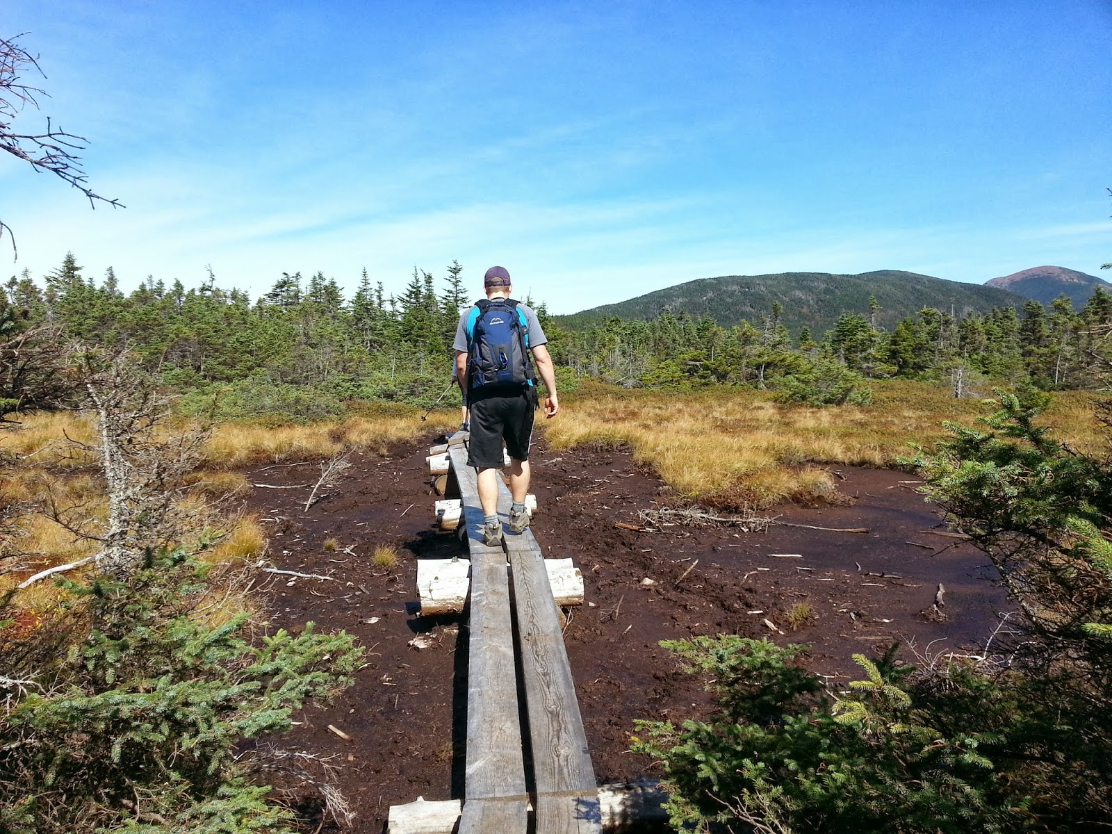
| Swamp crossings |
Though a decent distance, the hike over to Mt. Pierce was quite easy. At many points the trail crossed some swampy areas with man-made foot bridges, otherwise the majority of the traverse was relatively flat, with only a few sections that got your heart rate going. We were told that the final approach to Pierce was a bit steeper so it made sense that this section was not. At about .9 miles from the summit of Pierce we reached the
Mizpah Spring Hut, an Appalachian Mountain Club owned-hut. It was 12:20PM. We stopped inside to check it out. There were a few others inside eating lunch, relaxing, and enjoying the beautiful views from the oversized windows. I saw the menu for those staying over for the evening - a delicious sounding turkey dinner....wish I was staying! For some reason I am intrigued by the various huts scattered throughout the White Mountains - Paloma and I will definitely be putting my AMC membership to use next hiking season and plan on staying at a few of them. After a few minutes, we refilled our water bottles and headed out for the final push to the summit of Pierce.
 |
| Approaching the Mizpah Spring Hut |
Along the way we came across two guys, a young boy, and perhaps the largest, bleach white dog I have ever seen. For a second I thought we had come across a polar bear. The dog was carrying his own pack of food and looked to be enjoying the hike greatly. This section of the trail was quite a bit steeper than the traverse, and there were numerous spots where you had to use your hands to climb up man-made wooden steps over the steep rock faces. We emerged from the trees and reached the summit of Mt. Pierce at 1:05PM. Once again, we were treated with truly amazing views. We also, unfortunately, were treated with quite a bit of wind. We decided to snap a few photos but head down into some tree coverage to eat lunch. We were again joined by some grey jays looking for handouts, and had fun feeding them some crumbs from our food. Let's just say, I think my family has become legendary within the grey jay community.
 |
| Summit of Mt. Pierce |
I did want to point out something that we saw at the summit of Mt. Pierce that I thought was very admirable and thoughtful. Right near the cairn at the top was a small American flag with a laminated note card attached to it. On one side of the note card was a photo and short profile of a New Hampshire native who was killed in action in Baghdad during Operation Iraqi Freedom. On the reverse side was a note from the individual who placed it there, a New Hampshire native who is a disabled war veteran. He is attempting to hike all 48 four thousand footers and at the summit of each one, will be placing one of these cards profiling a different NH native who died in combat. What a great way to remember these folks.
 |
| Summit Memorial |
After we ate our lunch we began the descent down the Crawford Path towards the car, beginning the descent at 1:47PM. The Crawford Path, though rocky, is quite moderate in pitch, so we were cruising pretty quickly down towards the car. The moderate decline made it much easier on the knees as well. As we got closer to the bottom, we decided to take a short spur off the trail to check out Gibbs Falls, a small waterfall with a few rocks to sit on and enjoy the beauty. We took a couple of photos and headed back down, reaching the road at 3:17PM. The trailhead we parked at was about a quarter of a mile down the road from where we ended, so we had to walk for a few minutes along the road to get the car.
On the drive home, we decided to stop for dinner with my grandparents in Concord, NH. My father had two gift cards to the Longhorn Steakhouse, so we made the logical decision to go there. I wolfed down a nice 14oz. sirloin and a delicious sweet potato, washing it down with an Oktoberfest. Solid post-hike meal.
Overall this hike is relatively easy, but offers some amazing views and nice terrain. I highly recommend this to everyone, and it is certainly a hike that I will revisit in the future.
Hike Stats
Trails: Webster-Jackson, Webster Cliff, Crawford Path
Total Time (Including Breaks): 6:00
Distance: 8.3 Miles
Elevation Gain: 2650'


Thank you for writing this up and sharing. I'm tackling this loop tomorrow and appreciated your notes.
ReplyDelete